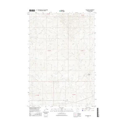
2017 Map of The Dugout
USGS Topo · Published 2017About this map
The Dugout sits at the southern edge of this landscape, marking a specific point of settlement amidst the complex drainage systems of Big Horn County. The area is defined by a network of seasonal and perennial waterways, including the winding course of Ninemile Cr and its tributary Little Ninemile Cr, which carve through the terrain. To the east, the elevation rises toward Haystack Butte, a prominent landmark overlooking the confluence of Lazy Man Cr and Big Meadow Cr. This 2017 survey by the U.S. Geological Survey illustrates the enduring reliance on named water sources like Dry Cr and S Cottonwood Cr to define land divisions and ranching boundaries. The map reflects a modern period of land management where traditional township and range lines, such as t1n r34e, intersect with a landscape shaped by both natural erosion and historic grazing use.
Find a feature on this map
16 named features on this map. Tap any name to fly to it.
Don’t see what you’re looking for? This feature index may not catch every label — zoom into the map to look around manually.
Map Details
Editions of this 2017 The Dugout Map
This is the sole edition of this map. No revisions or reprints were ever made.
Other maps of this area

1894 · Fort Custer
USGS Topo · 1:125,000

1954 · Hardin
USGS Topo · 1:250,000

1957 · Hardin
USGS Topo · 1:250,000

1958 · Hardin
USGS Topo · 1:250,000

1960 · Foster
USGS Topo · 1:24,000

1960 · Ninemile Point
USGS Topo · 1:24,000

1960 · Hardin
USGS Topo · 1:24,000

1967 · Crow Agency NE
USGS Topo · 1:24,000
1967 · Little Dry Creek
USGS Topo · 1:24,000
1972 · The Dugout
USGS Topo · 1:24,000