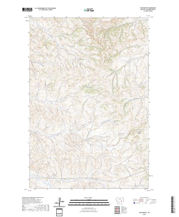
2024 Map of The Dugout
USGS Topo · Published 2024About this map
South Cottonwood Creek and Ninemile Creek weave through a landscape defined by an intricate network of drainages and high points in Big Horn County. This terrain is anchored by Haystack Butte, a prominent landmark that rises above the surrounding seasonal watercourses. The drainage patterns of Little Ninemile Creek and Lazy Man Creek illustrate the typical geomorphology of the Montana plains, where narrow valleys cut through the high prairie.
Find a feature on this map
15 named features on this map. Tap any name to fly to it.
Don’t see what you’re looking for? This feature index may not catch every label — zoom into the map to look around manually.
Map Details
Editions of this 2024 The Dugout Map
This is the sole edition of this map. No revisions or reprints were ever made.
Other maps of this area

1894 · Fort Custer
USGS Topo · 1:125,000

1954 · Hardin
USGS Topo · 1:250,000

1957 · Hardin
USGS Topo · 1:250,000

1958 · Hardin
USGS Topo · 1:250,000

1960 · Foster
USGS Topo · 1:24,000

1960 · Ninemile Point
USGS Topo · 1:24,000

1960 · Hardin
USGS Topo · 1:24,000

1967 · Crow Agency NE
USGS Topo · 1:24,000
1967 · Little Dry Creek
USGS Topo · 1:24,000
1972 · The Dugout
USGS Topo · 1:24,000