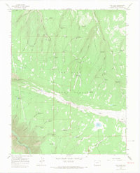
1964 Map of The Glade
USGS Topo · Published 1968About this map
The San Juan National Forest covers much of this landscape, dominated by the massive plateau known as The Glade. This high-elevation terrain is defined by a dense network of canyons and draws, including Dolores River Canyon in the southwest and Wolf Den Canyon to the north. The water management pattern across the forest is particularly distinctive, featuring dozens of small reservoirs such as Lower Glade Reservoir, Dead Snag Reservoir, and Pat Canyon Reservoir.
Find a feature on this map
67 named features on this map. Tap any name to fly to it.
Don’t see what you’re looking for? This feature index may not catch every label — zoom into the map to look around manually.
Map Details
Editions of this 1964 The Glade Map
3 editions found

Other maps of this area

1949 · Joe Davis Hill
USGS Topo · 1:24,000

1950 · Joe Davis Hill
USGS Topo · 1:24,000

1956 · Cortez
USGS Topo · 1:250,000

1958 · Cortez
USGS Topo · 1:250,000

1959 · Cortez
USGS Topo · 1:250,000

1962 · Cortez
USGS Topo · 1:250,000
1964 · Dawson Draw
USGS Topo · 1:24,000

1964 · Glade Mountain
USGS Topo · 1:24,000

1964 · Mc Kenna Peak
USGS Topo · 1:24,000
1964 · Secret Canyon
USGS Topo · 1:24,000