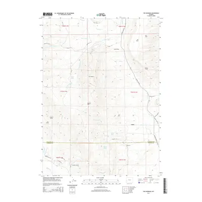
2015 Map of The Hogsback
USGS Topo · Published 2015About this map
The Hogsback and Hogsback Ridge dominate the central vertical axis of this Wyoming landscape, forming a prominent geological spine between the drainages of Dry Piney Cr and Birch Cr. The map captures the industrial and ranching character of Sublette and Lincoln Counties, particularly near the settlement of Calpet. A dense network of local roads such as Big Piney Calpet Rd and Battery 4 LaBarge Rd suggests active resource extraction or utility management in the vicinity.
Find a feature on this map
53 named features on this map. Tap any name to fly to it.
Don’t see what you’re looking for? This feature index may not catch every label — zoom into the map to look around manually.
Map Details
Editions of this 2015 The Hogsback Map
This is the sole edition of this map. No revisions or reprints were ever made.
Other maps of this area

1945 · Fort Hill
USGS Topo · 1:62,500

1947 · Fort Hill
USGS Topo · 1:62,500

1955 · Preston
USGS Topo · 1:250,000

1958 · Preston
USGS Topo · 1:250,000

1962 · Preston
USGS Topo · 1:250,000

1968 · Names Hill
USGS Topo · 1:24,000

1969 · Chimney Butte
USGS Topo · 1:24,000

1969 · La Barge
USGS Topo · 1:24,000

1969 · Cretaceous Mountain
USGS Topo · 1:24,000
1969 · The Hogsback
USGS Topo · 1:24,000