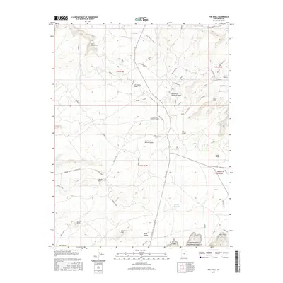
2017 Map of The Knoll
USGS Topo · Published 2017About this map
Canyonlands National Park borders the southern reaches of this landscape, where the high plateau of Big Flat drops away into a complex system of drainage and erosion. The terrain is defined by deep incisions like Hell Roaring Canyon and South Fork Mineral Canyon, which reveal the geologic layers of Grand County. Landmarks such as Jewel Tibbetts Arch and the prominent Beehive Butte provide navigational anchors in an area where the water is scarce, marked only by the isolated Big Flat Reservoir.
Find a feature on this map
53 named features on this map. Tap any name to fly to it.
Don’t see what you’re looking for? This feature index may not catch every label — zoom into the map to look around manually.
Map Details
Editions of this 2017 The Knoll Map
This is the sole edition of this map. No revisions or reprints were ever made.
Other maps of this area

1885 · La Sal
USGS Topo · 1:250,000

1951 · The Knoll
USGS Topo · 1:62,500

1951 · Upheaval Dome
USGS Topo · 1:62,500

1952 · Moab 4 NW
USGS Topo · 1:24,000

1952 · Moab 3 NE
USGS Topo · 1:24,000

1952 · Carlisle 2 NW
USGS Topo · 1:24,000

1952 · Moab 3 SE
USGS Topo · 1:24,000

1952 · Carlisle 2 NE
USGS Topo · 1:24,000

1952 · Moab 3 SW
USGS Topo · 1:24,000

1952 · Moab 4 SW
USGS Topo · 1:24,000