
1964 Map of The Needle Rocks
USGS Topo · Published 1965About this map
Geothermal activity and high desert shoreline define this 1964 survey of the western edge of Pyramid Lake. The distinctive tufa formations of The Needle Rocks stand out along the coast, accompanied by the Steam Geyser Hot Spring and several other thermal Hot Springs. This terrain is entirely within the Pyramid Lake Indian Reservation, showing a landscape where the Terraced Hills meet the water at Enchanted Beach and Wizards Cove.
Find a feature on this map
22 named features on this map. Tap any name to fly to it.
Don’t see what you’re looking for? This feature index may not catch every label — zoom into the map to look around manually.
Map Details
Editions of this 1964 The Needle Rocks Map
This is the sole edition of this map. No revisions or reprints were ever made.
Other maps of this area

1886 · Granite Range
USGS Topo · 1:250,000

1894 · Granite Range
USGS Topo · 1:250,000

1955 · Lovelock
USGS Topo · 1:250,000

1959 · Lovelock
USGS Topo · 1:250,000
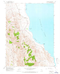
1964 · Pyramid SW
USGS Topo · 1:24,000
1964 · Astor Pass
USGS Topo · 1:24,000

1964 · Pyramid NE
USGS Topo · 1:24,000
1964 · Spanish Flat
USGS Topo · 1:24,000

1965 · Fox Range
USGS Topo · 1:62,500
1980 · Sand Pass
USGS Topo · 1:24,000