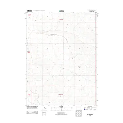
2013 Map of The Nipple SE
USGS Topo · Published 2013About this map
Red Wash Butte stands as a prominent landmark in this arid portion of Moffat County, overlooking a landscape defined by seasonal drainage systems and an established network of rural transit. The topography is shaped by the winding path of Greasewood Gulch in the north and the Red Wash in the south, illustrating the natural watercourses that dictate the movement and settlement patterns of this high-desert environment. This 2013 survey provides a clear view of the county infrastructure, tracing the paths of Co Road 21 and Co Road 50 across the varying elevations. The map provides essential detail for those studying the public land survey system, clearly delineating township and range boundaries including t010n r095w and its neighbors, which form the legal backbone of property and land management in this section of Colorado.
Find a feature on this map
15 named features on this map. Tap any name to fly to it.
Don’t see what you’re looking for? This feature index may not catch every label — zoom into the map to look around manually.
Map Details
Editions of this 2013 The Nipple SE Map
This is the sole edition of this map. No revisions or reprints were ever made.
Other maps of this area

1916 · Craig
USGS Topo · 1:125,000

1954 · Vernal
USGS Topo · 1:250,000

1954 · Craig
USGS Topo · 1:250,000

1957 · Craig
USGS Topo · 1:250,000

1958 · Vernal
USGS Topo · 1:250,000

1958 · Craig
USGS Topo · 1:250,000

1958 · Maybell
USGS Topo · 1:62,500

1960 · Craig
USGS Topo · 1:250,000

1960 · Vernal
USGS Topo · 1:250,000

1962 · Craig
USGS Topo · 1:250,000