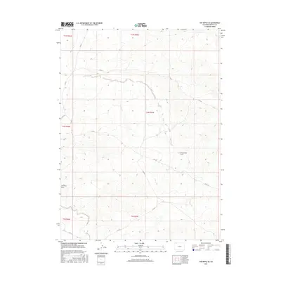
2016 Map of The Nipple SE
USGS Topo · Published 2016About this map
Red Wash Butte stands as a prominent landmark in this arid portion of Moffat County, overlooking a landscape defined by seasonal drainages and a network of county thoroughfares. The terrain is deeply incised by Greasewood Gulch and the winding course of Red Wash, reflecting the erosive forces characteristic of the Colorado plateau. A sparse but essential infrastructure of secondary roads, including Co Rd 21 and Co Rd 50, provides the only access through these high-elevation townships. This map is particularly useful for understanding the public land survey system divisions across townships 9 through 11 North, revealing how ranching and resource access are organized around natural topographic breaks and watercourses in a region where water is the primary sculptor of the land.
Find a feature on this map
15 named features on this map. Tap any name to fly to it.
Don’t see what you’re looking for? This feature index may not catch every label — zoom into the map to look around manually.
Map Details
Editions of this 2016 The Nipple SE Map
This is the sole edition of this map. No revisions or reprints were ever made.
Other maps of this area

1916 · Craig
USGS Topo · 1:125,000

1954 · Vernal
USGS Topo · 1:250,000

1954 · Craig
USGS Topo · 1:250,000

1957 · Craig
USGS Topo · 1:250,000

1958 · Vernal
USGS Topo · 1:250,000

1958 · Craig
USGS Topo · 1:250,000

1958 · Maybell
USGS Topo · 1:62,500

1960 · Craig
USGS Topo · 1:250,000

1960 · Vernal
USGS Topo · 1:250,000

1962 · Craig
USGS Topo · 1:250,000