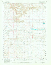
1958 Map of The Pinnacles
USGS Topo · Published 1968About this map
Honeycomb Buttes and the dramatic geology of The Pinnacles dominate this high-desert landscape in Sweetwater County during the late 1950s. The map captures a remote expanse defined by water management and ranching, where the presence of the Bar X Ranch and Bob Jack Well indicate the sparse but essential human footprint in the region. Hydrological features such as John Hay Reservoir and the Brannan Reservoir are critical infrastructure points, while the natural drainage of Alkali Draw and Bush Creek shapes the topography.
Find a feature on this map
26 named features on this map. Tap any name to fly to it.
Don’t see what you’re looking for? This feature index may not catch every label — zoom into the map to look around manually.
Map Details
Editions of this 1958 The Pinnacles Map
2 editions found
Other maps of this area

1954 · Rock Springs
USGS Topo · 1:250,000

1955 · Lander
USGS Topo · 1:250,000

1958 · Lander
USGS Topo · 1:250,000

1958 · Rock Springs
USGS Topo · 1:250,000

1958 · Twelvemile Well
USGS Topo · 1:62,500

1958 · Circle Bar Lake
USGS Topo · 1:24,000

1958 · Freighter Gap
USGS Topo · 1:62,500

1958 · The Pinnacles
USGS Topo · 1:62,500

1958 · Superior
USGS Topo · 1:62,500

1958 · Dickie Springs
USGS Topo · 1:24,000