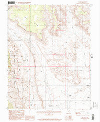
1987 Map of The Post
USGS Topo · Published 1987About this map
Capitol Reef National Park and its dramatic geologic formations dominate this 1980s landscape in Garfield County. The map details the striking Waterpocket Fold, a monocline that defines the local topography, alongside deep drainages like Muley Twist Canyon and the expansive Grand Gulch. While the area is largely characterized by its natural features, the presence of The Post and various water catchments such as Willow Tanks, Cottonwood Tanks, and Muley Tanks indicates the infrastructure required for navigating or ranching in this arid environment.
Find a feature on this map
19 named features on this map. Tap any name to fly to it.
Don’t see what you’re looking for? This feature index may not catch every label — zoom into the map to look around manually.
Map Details
Editions of this 1987 The Post Map
2 editions found
Other maps of this area

1886 · Escalante
USGS Topo · 1:250,000

1886 · Henry Mountains
USGS Topo · 1:250,000

1892 · Henry Mountains
USGS Topo · 1:250,000

1952 · Mt Pennell 2 NE
USGS Topo · 1:24,000

1953 · Mt Pennell
USGS Topo · 1:62,500

1953 · Circle Cliffs 1 SE
USGS Topo · 1:24,000

1953 · Mt Pennell 2 SE
USGS Topo · 1:24,000

1953 · Mt Pennell 3 NW
USGS Topo · 1:24,000
1953 · Circle Cliffs 1 NE
USGS Topo · 1:24,000

1953 · Mt Pennell 2 SW
USGS Topo · 1:24,000