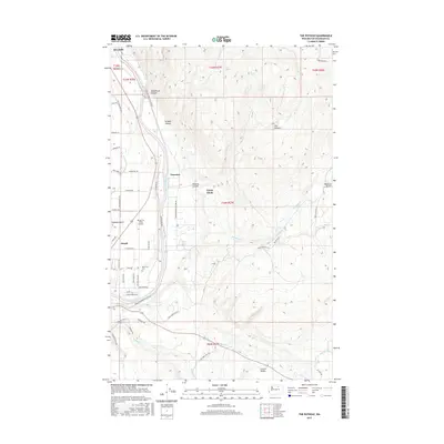
2017 Map of The Pothole
USGS Topo · Published 2017About this map
The Okanogan River flows south through this 2017 landscape, anchoring a corridor of development between Riverside and Omak. The map illustrates the concentration of residential and agricultural lands along the river valley floor, where streets like Red Apple Dr and Orchard View Dr reflect the region's orchard economy. Higher elevations to the east reveal a more dramatic topography, characterized by the Wanacut Basin and the distinct depression known as The Pothole. This transition from the river bottom to the high plateau involves several named drainages, including Swipkin Canyon and Pothole Canyon. Local landmarks such as the Riverview Cem and the Wings For Christ Airport provide specific points of interest for genealogists and local historians tracking the modern footprint of these Okanogan County communities.
Find a feature on this map
55 named features on this map. Tap any name to fly to it.
Don’t see what you’re looking for? This feature index may not catch every label — zoom into the map to look around manually.
Map Details
Editions of this 2017 The Pothole Map
This is the sole edition of this map. No revisions or reprints were ever made.
Other maps of this area

1902 · Osoyoos
USGS Topo · 1:125,000

1904 · Osoyoos
USGS Topo · 1:125,000

1905 · Okanogan
USGS Topo · 1:125,000

1906 · Chopaka
USGS Topo · 1:125,000

1953 · Omak Lake
USGS Topo · 1:62,500

1954 · Okanogan
USGS Topo · 1:250,000

1957 · Okanogan
USGS Topo · 1:62,500

1957 · Conconully
USGS Topo · 1:62,500

1957 · Tonasket
USGS Topo · 1:62,500

1958 · Okanogan
USGS Topo · 1:250,000