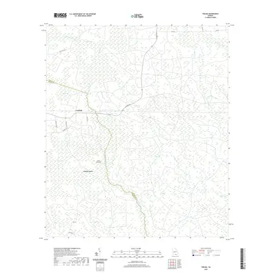
2020 Map of Thelma
USGS Topo · Published 2020About this map
Fruitland and the settlement of Thelma occupy a landscape defined by an intricate network of wetlands and small watercourses along the Clinch Co Echols Co line. The terrain is characterized by numerous bays—depressions often filled with marsh or timber—including McClain Bay, Whitehead Bay, and Stalvey Bay. These features, along with Briary Bay and Anderson Bay, indicate a low-lying, water-dominant geography where agriculture and habitation are concentrated along slightly higher ground traversed by W Forest Ave. The drainage system is particularly dense, with Suwannoochee Cr and its tributaries like Sweetwater Cr and Sandy Br carving through the timberlands. Notable landmarks such as Indian Hammock and Beryl Lake provide specific points of interest for those studying the local topography of Echols County and the surrounding coastal plain environment as it appeared in the early 21st century.
Find a feature on this map
41 named features on this map. Tap any name to fly to it.
Don’t see what you’re looking for? This feature index may not catch every label — zoom into the map to look around manually.
Map Details
Editions of this 2020 Thelma Map
This is the sole edition of this map. No revisions or reprints were ever made.
Other maps of this area

1954 · Valdosta
USGS Topo · 1:250,000

1958 · Valdosta
USGS Topo · 1:250,000

1959 · Valdosta
USGS Topo · 1:250,000

1968 · Midway
USGS Topo · 1:24,000

1968 · Needmore
USGS Topo · 1:24,000

1968 · Headlight
USGS Topo · 1:24,000

1971 · Thelma
USGS Topo · 1:24,000

1971 · Du Pont
USGS Topo · 1:24,000

1971 · Stockton
USGS Topo · 1:24,000

1971 · Tarver
USGS Topo · 1:24,000