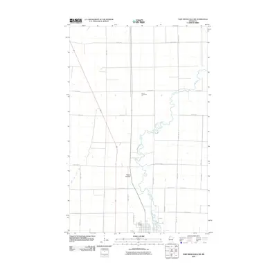
2010 Map of Thief River Falls NW
USGS Topo · Published 2010About this map
The meandering Thief River dominates this portion of Pennington County, winding through a landscape organized by a rigorous grid of section lines and county roads. In the early 21st century, the area north of the city center is defined by rural community landmarks and transit intersections. Local heritage is grounded at the Saint Bernard Cemetery near the river's bend and the Steiner Community Hall further north. The map records the infrastructure of the region, including the rail-road intersection at Dakota Junction and the path of Dewey Ave N as it extends toward the rural outskirts. This geography illustrates the persistent agricultural and community patterns of northwestern Minnesota, where township roads like 250th St NE and County Hwy-2 provide the primary framework for movement between isolated homesteads and community hubs.
Find a feature on this map
26 named features on this map. Tap any name to fly to it.
Don’t see what you’re looking for? This feature index may not catch every label — zoom into the map to look around manually.
Map Details
Editions of this 2010 Thief River Falls NW Map
This is the sole edition of this map. No revisions or reprints were ever made.
Other maps of this area

1918 · Viking
USGS Topo · 1:62,500

1918 · Middle River
USGS Topo · 1:62,500

1943 · Thief River Falls
USGS Topo · 1:62,500

1952 · Thief River Falls
USGS Topo · 1:250,000

1956 · Thief River Falls
USGS Topo · 1:250,000

1957 · Thief River Falls
USGS Topo · 1:250,000

1957 · Newfolden
USGS Topo · 1:62,500

1959 · Rosewood
USGS Topo · 1:24,000
1959 · Thief River Falls
USGS Topo · 1:24,000
1959 · Viking SE
USGS Topo · 1:24,000