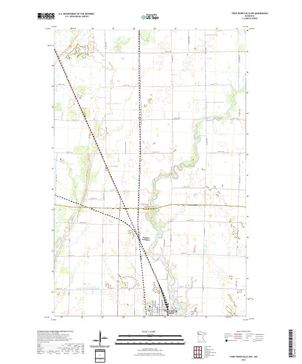
2022 Map of Thief River Falls NW
USGS Topo · Published 2022About this map
The Thief River meanders southward through this rural corridor on the border of Marshall Co and Pennington Co, charting the transition from expansive agricultural fields to the northern outskirts of Thief River Falls. The landscape is defined by a rigid section-line road grid, including 250th St NE and 200th St NE, which accommodate the large-scale farming operations characteristic of this Red River Valley region. Near the southern edge of the sheet, the river valley tightens as it enters the city limits, passing by the Saint Bernard Cem and the rail-oriented site of Dakota Junction. The presence of substantial water management projects, like the County Ditch Number Seventy, illustrates the region's long-standing efforts to drain and utilize the fertile but historically marshy plains for productive agriculture.
Find a feature on this map
24 named features on this map. Tap any name to fly to it.
Don’t see what you’re looking for? This feature index may not catch every label — zoom into the map to look around manually.
Map Details
Editions of this 2022 Thief River Falls NW Map
This is the sole edition of this map. No revisions or reprints were ever made.
Other maps of this area

1918 · Viking
USGS Topo · 1:62,500

1918 · Middle River
USGS Topo · 1:62,500

1943 · Thief River Falls
USGS Topo · 1:62,500

1952 · Thief River Falls
USGS Topo · 1:250,000

1956 · Thief River Falls
USGS Topo · 1:250,000

1957 · Thief River Falls
USGS Topo · 1:250,000

1957 · Newfolden
USGS Topo · 1:62,500

1959 · Rosewood
USGS Topo · 1:24,000
1959 · Thief River Falls
USGS Topo · 1:24,000
1959 · Viking SE
USGS Topo · 1:24,000