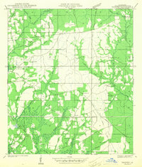
1942 Map of Thigpen
USGS Topo · Published 1942About this map
The Bogue Chitto River defines the southwestern corner of this Washington Parish landscape, captured just before the United States entered the Second World War. This interior region of Louisiana is characterized by a dense network of creek branches, including Thigpen Creek and Lawrence Creek, which historically supported a landscape of timber and rural homesteads. Small rural hubs such as Springhill and Pine Cliff are mapped alongside the Gulf Mobile and Ohio railroad line, showing the importance of rail transport to the local economy during the early 1940s.
Find a feature on this map
39 named features on this map. Tap any name to fly to it.
Don’t see what you’re looking for? This feature index may not catch every label — zoom into the map to look around manually.
Map Details
Editions of this 1942 Thigpen Map
2 editions found
Other maps of this area

1939 · Zona
USGS Topo · 1:31,680

1939 · Clifton
USGS Topo · 1:31,680

1942 · Thigpen
USGS Topo · 1:31,680

1942 · Rio
USGS Topo · 1:31,680

1942 · Thomas
USGS Topo · 1:31,680

1949 · Bogalusa West
USGS Topo · 1:31,680

1950 · Folsom
USGS Topo · 1:31,680

1950 · Crains Creek
USGS Topo · 1:31,680

1950 · Franklinton
USGS Topo · 1:31,680

1953 · Mobile
USGS Topo · 1:250,000