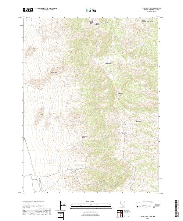
2021 Map of Third Butte East
USGS Topo · Published 2021About this map
The high peaks and drainages of the Snake Range define this high-altitude landscape in White Pine County. The topography is anchored by a series of distinct landmarks, including First Butte, Second Butte, and Third Butte in the west, and the towering White Cloud Mtn and O'Neal Peak to the north and east. These summits overlook a network of seasonal water sources and deep incisions like Eightmile Canyon, Dry Canyon, and Marble Wash.
Find a feature on this map
27 named features on this map. Tap any name to fly to it.
Don’t see what you’re looking for? This feature index may not catch every label — zoom into the map to look around manually.
Map Details
Editions of this 2021 Third Butte East Map
This is the sole edition of this map. No revisions or reprints were ever made.
Other maps of this area

1956 · Ely
USGS Topo · 1:250,000

1959 · Ely
USGS Topo · 1:250,000

1963 · Ely
USGS Topo · 1:250,000
1986 · Mount Moriah
USGS Topo · 1:24,000
1986 · Third Butte West
USGS Topo · 1:24,000
1986 · Yelland Dry Lake
USGS Topo · 1:24,000
1986 · Big Hard Pan
USGS Topo · 1:24,000
1986 · Sixmile Canyon
USGS Topo · 1:24,000
1986 · Mormon Jack Pass
USGS Topo · 1:24,000
1986 · White Cloud Point
USGS Topo · 1:24,000