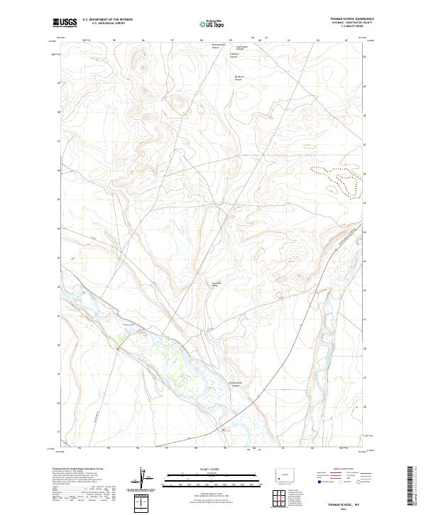
2021 Map of Thoman School
USGS Topo · Published 2021About this map
The Green River and Big Sandy River converge in this high-desert portion of Sweetwater County, shaping a landscape defined by deep drainages and isolated landmarks. The Thoman School stands as a focal point in the southwestern quadrant, situated near the winding course of the Green River. The surrounding terrain is heavily dissected by several named canyons, including Eighteenmile Canyon, Twelvemile Canyon, Lombard Canyon, and Buckhorn Canyon, which reflect the rugged drainage patterns leading toward the river basins.
Find a feature on this map
17 named features on this map. Tap any name to fly to it.
Don’t see what you’re looking for? This feature index may not catch every label — zoom into the map to look around manually.
Map Details
Editions of this 2021 Thoman School Map
This is the sole edition of this map. No revisions or reprints were ever made.
Other maps of this area

1954 · Rock Springs
USGS Topo · 1:250,000

1955 · Lander
USGS Topo · 1:250,000

1958 · Lander
USGS Topo · 1:250,000

1958 · Rock Springs
USGS Topo · 1:250,000

1961 · Lander
USGS Topo · 1:250,000

1962 · Rock Springs
USGS Topo · 1:250,000

1963 · Gasson Bridge
USGS Topo · 1:24,000

1963 · Big Island Bridge
USGS Topo · 1:24,000
1963 · Whiskey Buttes
USGS Topo · 1:24,000
1963 · Mc Cullen Bluff
USGS Topo · 1:24,000