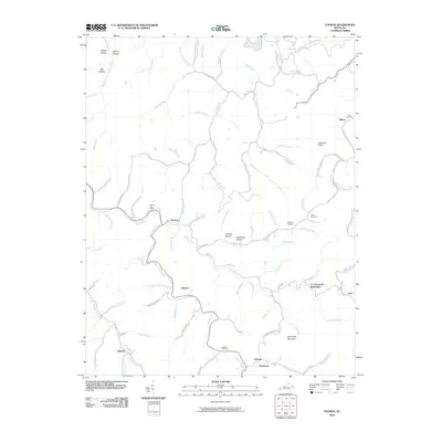
2010 Map of Thomas
USGS Topo · Published 2010About this map
Thomas and its central Thomas Post Office serve as a focal point for this rural landscape in eastern Kentucky. The terrain is characterized by a dense network of named hollows and creek branches, reflecting a settlement pattern deeply tied to the narrow valley floors and ridges. Along the waterways of Johns Creek, Wolf Creek, and Brushy Fork, small communities and named locations like Banyan, Lowe, and Gulnare are established. Higher elevations are marked by prominent landmarks such as Chestnut Knob and Sycamore Mountain.
Find a feature on this map
91 named features on this map. Tap any name to fly to it.
Don’t see what you’re looking for? This feature index may not catch every label — zoom into the map to look around manually.
Map Details
Editions of this 2010 Thomas Map
This is the sole edition of this map. No revisions or reprints were ever made.
Other maps of this area

1886 · Prestonsburg
USGS Topo · 1:125,000

1887 · Warfield
USGS Topo · 1:125,000

1891 · Warfield
USGS Topo · 1:125,000

1892 · Prestonsburg
USGS Topo · 1:125,000

1910 · Naugatuck
USGS Topo · 1:48,000

1912 · Naugatuck
USGS Topo · 1:62,500

1914 · Laynesville
USGS Topo · 1:48,000

1914 · Inez
USGS Topo · 1:48,000

1915 · Williamson
USGS Topo · 1:48,000

1915 · Naugatuck
USGS Topo · 1:48,000