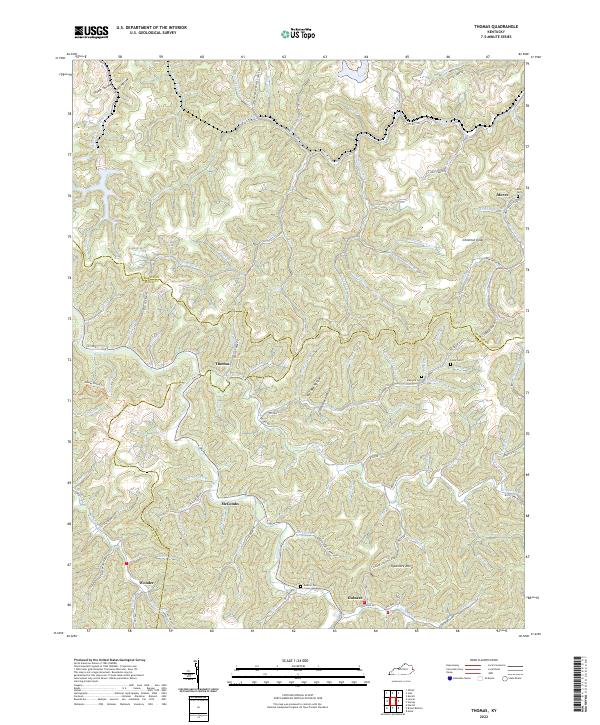
2022 Map of Thomas
USGS Topo · Published 2022About this map
The rugged intersections of Martin, Floyd, and Pike counties define this landscape, where small communities like Thomas and McCombs are connected by winding hollows and narrow creek beds. The drainage patterns of Wolf Cr and Brushy Fork dictate the location of roads and homesteads, creating a classic Eastern Kentucky settlement profile. Genealogists will find several family-named landmarks, including the Maynard Cem and Kirk Cem, situated near the headwaters of numerous branches. Higher elevations are marked by prominent points such as Chestnut Knob and Sycamore Mtn, while local transport is facilitated by routes like State Hwy 3385 and the Dewey Horse Trl. The map illustrates a contemporary view of these traditional coal-country hollows, showing the enduring nature of places like Gulnare and Wonder along the winding ridgelines.
Find a feature on this map
104 named features on this map. Tap any name to fly to it.
Don’t see what you’re looking for? This feature index may not catch every label — zoom into the map to look around manually.
Map Details
Editions of this 2022 Thomas Map
This is the sole edition of this map. No revisions or reprints were ever made.
Other maps of this area

1886 · Prestonsburg
USGS Topo · 1:125,000

1887 · Warfield
USGS Topo · 1:125,000

1891 · Warfield
USGS Topo · 1:125,000

1892 · Prestonsburg
USGS Topo · 1:125,000

1910 · Naugatuck
USGS Topo · 1:48,000

1912 · Naugatuck
USGS Topo · 1:62,500

1914 · Laynesville
USGS Topo · 1:48,000

1914 · Inez
USGS Topo · 1:48,000

1915 · Williamson
USGS Topo · 1:48,000

1915 · Naugatuck
USGS Topo · 1:48,000