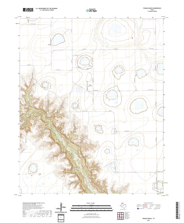
2022 Map of Thomas Ranch
USGS Topo · Published 2022About this map
Palo Duro Canyon dominates the southwestern portion of this map, where the dramatic incision of the Prairie Dog Town Fork Red River creates a complex network of draws and side canyons. This rugged topography includes family-named landmarks and distinct geographical features like Chalk Hollow, Deep Canyon, and Thomas Draw. The contrasts between the deep erosional breaks and the flat Llano Estacado plains to the north and east are sharp, marked by the transition from canyon walls to the rectilinear grid of Randall County roads.
Find a feature on this map
39 named features on this map. Tap any name to fly to it.
Don’t see what you’re looking for? This feature index may not catch every label — zoom into the map to look around manually.
Map Details
Editions of this 2022 Thomas Ranch Map
This is the sole edition of this map. No revisions or reprints were ever made.
Other maps of this area

1954 · Amarillo
USGS Topo · 1:250,000

1954 · Plainview
USGS Topo · 1:250,000

1956 · Fortress Cliff
USGS Topo · 1:24,000

1956 · Amarillo East
USGS Topo · 1:24,000

1956 · Washburn
USGS Topo · 1:24,000

1956 · Thomas Ranch
USGS Topo · 1:24,000

1956 · Pullman
USGS Topo · 1:24,000

1958 · Amarillo
USGS Topo · 1:250,000

1958 · Plainview
USGS Topo · 1:250,000

1960 · Canyon
USGS Topo · 1:62,500