
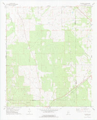
1968 Map of Thomaston East
USGS Topo · Published 1971About this map
Thomaston serves as the primary hub in this late-1960s survey of eastern Marengo County, where the Louisville and Nashville railroad cuts across the southern landscape. The terrain is defined by a dense network of tributaries including Chickasaw Creek, Bogue Creek, and Poplar Creek, which feed into localized landmarks like Stallworths Shadow Lake. This period of Alabama history is reflected in the numerous rural community centers that dot the quadrangle, including the settlements of McKinley and Consul.
Find a feature on this map
28 named features on this map. Tap any name to fly to it.
Don’t see what you’re looking for? This feature index may not catch every label — zoom into the map to look around manually.
Map Details
Editions of this 1968 Thomaston East Map
This is the sole edition of this map. No revisions or reprints were ever made.
Other maps of this area

1953 · Montgomery
USGS Topo · 1:250,000

1956 · Montgomery
USGS Topo · 1:250,000

1957 · Montgomery
USGS Topo · 1:250,000

1968 · Uniontown West
USGS Topo · 1:24,000

1968 · Uniontown East
USGS Topo · 1:24,000

1968 · Thomaston West
USGS Topo · 1:24,000

1968 · Gallion
USGS Topo · 1:24,000

1968 · Central Mills
USGS Topo · 1:24,000

1974 · Catherine
USGS Topo · 1:24,000
1978 · Flatwood
USGS Topo · 1:24,000