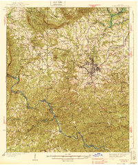
1939 Map of Thomaston
USGS Topo · Published 1939About this map
Thomaston and its industrial satellites Silvertown and East Thomaston anchor this 1930s survey of Upson County. The map captures a landscape defined by the Central of Georgia railroad and the significant water power of the Flint River. Along the northern reaches, small agrarian clusters like McCrary Settlement and Jones Settlement represent the rural character of the era, while specialized landmarks like the Martha Berry Sch and Matthews Country Club suggest the social and educational fabric of the community.
Find a feature on this map
72 named features on this map. Tap any name to fly to it.
Don’t see what you’re looking for? This feature index may not catch every label — zoom into the map to look around manually.
Map Details
Editions of this 1939 Thomaston Map
3 editions found
Other maps of this area

1907 · Talbotton
USGS Topo · 1:125,000

1934 · Warm Springs
USGS Topo · 1:62,500

1935 · Thomaston
USGS Topo · 1:48,000

1936 · Warm Springs
USGS Topo · 1:62,500

1939 · Thomaston
USGS Topo · 1:62,500

1950 · Talbotton
USGS Topo · 1:24,000

1950 · Talbotton
USGS Topo · 1:62,500

1951 · Yatesville
USGS Topo · 1:62,500

1951 · Barnesville
USGS Topo · 1:62,500

1953 · Atlanta
USGS Topo · 1:250,000