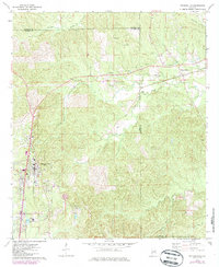
1973 Map of Thomasville
USGS Topo · Published 1986About this map
Thomasville serves as the primary hub in this southwest Alabama landscape, situated at the junction of several key routes and the Southern railroad line. The map reflects a mid-1970s snapshot of growth, featuring the State Technical Institute and a local Hospital alongside established neighborhoods. Moving east from the town center, the terrain transitions into a more rural pattern of family-named settlements and crossroads like Atkeison and Finley Crossing.
Find a feature on this map
34 named features on this map. Tap any name to fly to it.
Don’t see what you’re looking for? This feature index may not catch every label — zoom into the map to look around manually.
Map Details
Editions of this 1973 Thomasville Map
2 editions found
Other maps of this area

1953 · Montgomery
USGS Topo · 1:250,000

1953 · Andalusia
USGS Topo · 1:250,000

1956 · Montgomery
USGS Topo · 1:250,000

1957 · Montgomery
USGS Topo · 1:250,000

1957 · Andalusia
USGS Topo · 1:250,000

1973 · Fulton East
USGS Topo · 1:24,000

1973 · Pine Hill
USGS Topo · 1:24,000

1973 · Thomasville
USGS Topo · 1:24,000

1973 · Lower Peach Tree
USGS Topo · 1:24,000

1978 · Surginer
USGS Topo · 1:24,000