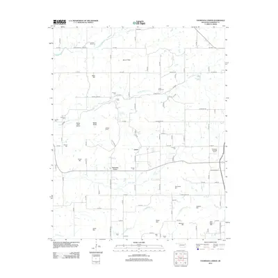
2012 Map of Thompson Corner
USGS Topo · Published 2012About this map
Thompson Corner and Shady Grove anchor the landscape of this Cherokee County survey, where small rural settlements and family cemeteries define the social geography west of the regional hub of Tahlequah. The area is characterized by a high density of historical burial sites, including the Swimmer Baptist Cem, Crittenden Cem, and Mt Zion Cem, often associated with the numerous ridges and knobs that break the terrain.
Find a feature on this map
69 named features on this map. Tap any name to fly to it.
Don’t see what you’re looking for? This feature index may not catch every label — zoom into the map to look around manually.
Map Details
Editions of this 2012 Thompson Corner Map
This is the sole edition of this map. No revisions or reprints were ever made.
Other maps of this area

1896 · Pryor
USGS Topo · 1:125,000

1898 · Tahlequah
USGS Topo · 1:125,000

1899 · Siloam Springs
USGS Topo · 1:125,000

1901 · Muscogee
USGS Topo · 1:125,000

1901 · Pryor
USGS Topo · 1:125,000

1901 · Tahlequah
USGS Topo · 1:125,000

1903 · Siloam Springs
USGS Topo · 1:125,000

1904 · Siloam Springs
USGS Topo · 1:125,000

1905 · Muscogee
USGS Topo · 1:125,000

1905 · Tahlequah
USGS Topo · 1:125,000