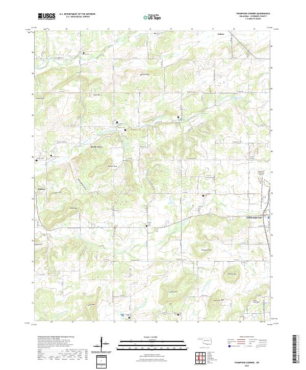
2022 Map of Thompson Corner
USGS Topo · Published 2022About this map
The western edges of Tahlequah and the rural communities of Gideon and Shady Grove define the landscape of Cherokee County in this recent topographical study. The map illustrates a region transitioning from the suburban outskirts of the county seat to the wooded uplands of the Boston Mountains. High points like Bynum Ridge and Keener Knob overlook a network of creek valleys, including Fourteenmile Creek and Double Spring Creek.
Find a feature on this map
79 named features on this map. Tap any name to fly to it.
Don’t see what you’re looking for? This feature index may not catch every label — zoom into the map to look around manually.
Map Details
Editions of this 2022 Thompson Corner Map
This is the sole edition of this map. No revisions or reprints were ever made.
Other maps of this area

1896 · Pryor
USGS Topo · 1:125,000

1898 · Tahlequah
USGS Topo · 1:125,000

1899 · Siloam Springs
USGS Topo · 1:125,000

1901 · Muscogee
USGS Topo · 1:125,000

1901 · Pryor
USGS Topo · 1:125,000

1901 · Tahlequah
USGS Topo · 1:125,000

1903 · Siloam Springs
USGS Topo · 1:125,000

1904 · Siloam Springs
USGS Topo · 1:125,000

1905 · Muscogee
USGS Topo · 1:125,000

1905 · Tahlequah
USGS Topo · 1:125,000