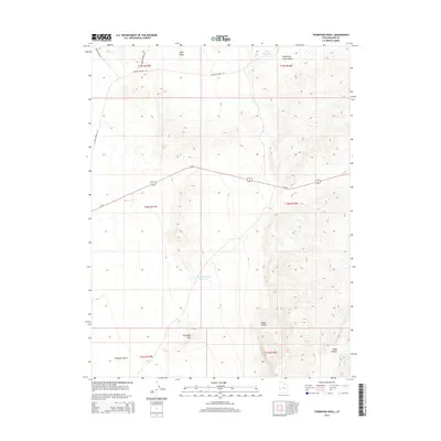
2014 Map of Thompson Knoll
USGS Topo · Published 2014About this map
Us-50 bisects this Millard County landscape, a central artery through an arid basin characterized by catchments and named desert depressions. The local geography is defined by its water management for livestock and transit, evidenced by Conger Reservoir in the north and Thompson Knoll Reservoir further south. These features serve as vital landmarks in an area dominated by the Ferguson Desert and various canyons.
Find a feature on this map
18 named features on this map. Tap any name to fly to it.
Don’t see what you’re looking for? This feature index may not catch every label — zoom into the map to look around manually.
Map Details
Editions of this 2014 Thompson Knoll Map
This is the sole edition of this map. No revisions or reprints were ever made.
Other maps of this area
1908 · Fish Springs
USGS Topo · 1:250,000
1910 · Fish Springs
USGS Topo · 1:250,000

1953 · Richfield
USGS Topo · 1:250,000

1953 · Delta
USGS Topo · 1:250,000

1958 · Richfield
USGS Topo · 1:250,000

1958 · Delta
USGS Topo · 1:250,000
1960 · Conger Range
USGS Topo · 1:62,500
1960 · Burbank Hills
USGS Topo · 1:62,500
1960 · Crystal Peak
USGS Topo · 1:62,500
1960 · Conger Mountain
USGS Topo · 1:62,500