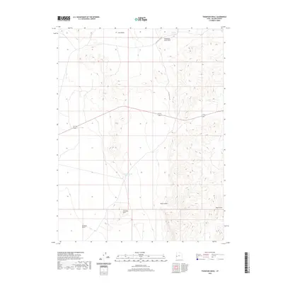
2020 Map of Thompson Knoll
USGS Topo · Published 2020About this map
Thompson Knoll rises as a prominent landmark in this desert region of Millard County, providing a high-ground anchor for water management in an arid landscape. The 2020 topography shows a network of catchments and drainage patterns, including Thompson Knoll Reservoir and Conger Reservoir to the north. These features, along with the descriptively named Mile And A Half Rd, suggest a landscape historically shaped by grazing and seasonal water access.
Find a feature on this map
9 named features on this map. Tap any name to fly to it.
Don’t see what you’re looking for? This feature index may not catch every label — zoom into the map to look around manually.
Map Details
Editions of this 2020 Thompson Knoll Map
This is the sole edition of this map. No revisions or reprints were ever made.
Other maps of this area

1908 · Fish Springs
USGS Topo · 1:250,000

1910 · Fish Springs
USGS Topo · 1:250,000

1953 · Richfield
USGS Topo · 1:250,000

1953 · Delta
USGS Topo · 1:250,000

1958 · Richfield
USGS Topo · 1:250,000

1958 · Delta
USGS Topo · 1:250,000

1960 · Conger Range
USGS Topo · 1:62,500

1960 · Burbank Hills
USGS Topo · 1:62,500

1960 · Crystal Peak
USGS Topo · 1:62,500

1960 · Conger Mountain
USGS Topo · 1:62,500