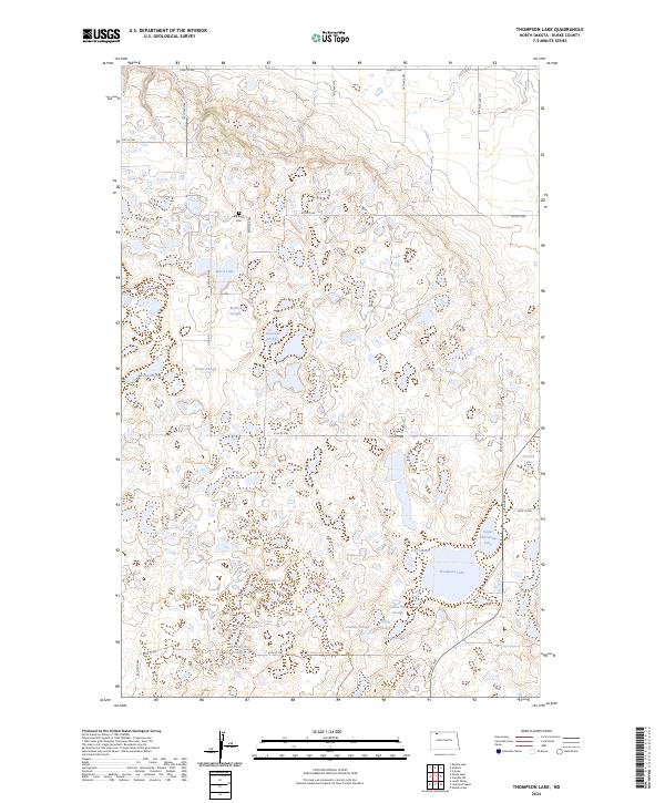
2024 Map of Thompson Lake
USGS Topo · Published 2024About this map
The glacial prairie pothole region of North Dakota is on full display in this Burke County landscape, dominated by the protected wetlands of the Lostwood National Wildlife Refuge and the Lostwood Wilderness. This complex network of water bodies includes Thompson Lake, Ward Lake, and Kirkland Lake, interspersed with numerous ecologically significant sloughs like Melbys Slough and Goose Pan Slough. These features reflect the post-glacial topography where depressions in the drift plain create essential habitats for migratory birds, formalised in the Burke County Waterfowl Production Area.
Find a feature on this map
32 named features on this map. Tap any name to fly to it.
Don’t see what you’re looking for? This feature index may not catch every label — zoom into the map to look around manually.
Map Details
Editions of this 2024 Thompson Lake Map
This is the sole edition of this map. No revisions or reprints were ever made.
Other maps of this area

1948 · Coteau
USGS Topo · 1:24,000

1948 · Woburn
USGS Topo · 1:24,000

1948 · Vanville NE
USGS Topo · 1:24,000

1949 · Rennie Lake
USGS Topo · 1:24,000

1950 · Vanville NE
USGS Topo · 1:24,000

1950 · Flaxton
USGS Topo · 1:62,500

1950 · Portal
USGS Topo · 1:62,500

1953 · Williston
USGS Topo · 1:250,000

1957 · Williston
USGS Topo · 1:250,000
1974 · Thompson Lake
USGS Topo · 1:24,000