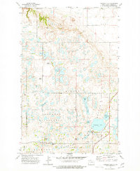
1974 Map of Thompson Lake
USGS Topo · Published 1977About this map
The Lostwood National Wildlife Refuge dominates this section of Burke County, where a dense concentration of prairie potholes and sloughs creates a complex, aquatic landscape. This 1974 survey documents a terrain defined by glacial activity, featuring numerous named water bodies like Iverson Lake, Ward Lake, and the expansive Thompson Lake. The presence of the Lostwood Wilderness area highlights the preservation of this unique ecosystem, characterized by natural depressions such as Swensens Slough and Melbys Slough.
Find a feature on this map
30 named features on this map. Tap any name to fly to it.
Don’t see what you’re looking for? This feature index may not catch every label — zoom into the map to look around manually.
Map Details
Editions of this 1974 Thompson Lake Map
This is the sole edition of this map. No revisions or reprints were ever made.
Other maps of this area

1948 · Coteau
USGS Topo · 1:24,000

1948 · Woburn
USGS Topo · 1:24,000

1948 · Vanville NE
USGS Topo · 1:24,000

1949 · Rennie Lake
USGS Topo · 1:24,000

1950 · Vanville NE
USGS Topo · 1:24,000

1950 · Flaxton
USGS Topo · 1:62,500

1950 · Portal
USGS Topo · 1:62,500

1953 · Williston
USGS Topo · 1:250,000

1957 · Williston
USGS Topo · 1:250,000
1974 · Helde Lake
USGS Topo · 1:24,000