
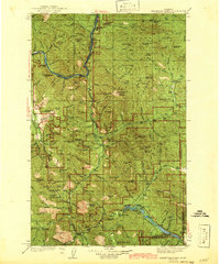
1942 Map of Thompson Lakes
USGS Topo · Published 1942About this map
Kootenai River and Fisher River define the topography of this corner of Northwest Montana, where the Great Northern Railway tracks follow the river's bend near Warland and Jennings. The landscape is heavily marked by early 20th-century forest management and industrial interests, evidenced by the high density of fire observation points such as Alexander Mtn Lookout and Tony Pk Lookout. The presence of Zonolite Mtn points toward the region's significant mineral history, while small rural education centers like Pleasant Valley Sch and McInnis Meadows Sch serve isolated homesteads and timber camps. National forest boundaries for the Kootenai, Flathead, and Cabinet converge here, emphasizing the transition between major wilderness districts and the early road system that would become U. S. Route 2.
Find a feature on this map
77 named features on this map. Tap any name to fly to it.
Don’t see what you’re looking for? This feature index may not catch every label — zoom into the map to look around manually.
Map Details
Editions of this 1942 Thompson Lakes Map
2 editions found
Other maps of this area

1913 · Stryker
USGS Topo · 1:125,000

1916 · Stryker
USGS Topo · 1:125,000

1920 · Libby
USGS Topo · 1:125,000

1920 · Jennings
USGS Topo · 1:125,000

1930 · Libby
USGS Topo · 1:125,000

1932 · Libby
USGS Topo · 1:125,000

1932 · Trout Creek
USGS Topo · 1:125,000

1935 · Thompson Lakes
USGS Topo · 1:96,000

1935 · Trout Creek
USGS Topo · 1:125,000

1936 · Trout Creek
USGS Topo · 1:125,000