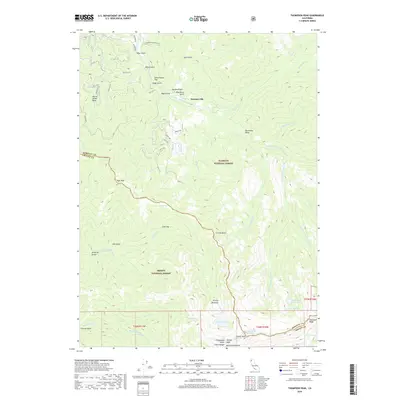
2018 Map of Thompson Peak
USGS Topo · Published 2018About this map
Summerville is situated along the high drainage of the S Fork Salmon River, where the Klamath National Forest and Trinity National Forest meet. This terrain is defined by the high elevations of the Trinity Alps and Salmon Mountains, featuring landmarks like Thompson Peak and Caesar Peak. The map documents a rugged landscape punctuated by glacial features, including Grizzly Lake, Moraine Lake, and Emerald Lake below the sharp crest of Sawtooth Ridge. Traces of human activity are concentrated in the north, including the Petersburg Water System and named tracts like Schoolhouse Flat. Numerous gulches such as Stage Gulch, Black Gulch, and Garden Gulch suggest a history of exploration and extraction near Yellow Jacket Basin. The boundary between Siskiyou and Trinity counties cuts through this high country, marking a transition between these protected forest lands.
Find a feature on this map
72 named features on this map. Tap any name to fly to it.
Don’t see what you’re looking for? This feature index may not catch every label — zoom into the map to look around manually.
Map Details
Editions of this 2018 Thompson Peak Map
This is the sole edition of this map. No revisions or reprints were ever made.
Other maps of this area

1886 · Shasta
USGS Topo · 1:250,000

1890 · Red Bluff
USGS Topo · 1:250,000

1894 · Red Bluff
USGS Topo · 1:250,000

1894 · Shasta
USGS Topo · 1:250,000

1909 · Big Bar
USGS Topo · 1:96,000

1913 · Weaverville
USGS Topo · 1:125,000

1915 · Big Bar and Vicinity
USGS Topo · 1:250,000

1923 · Sawyers Bar
USGS Topo · 1:125,000

1931 · Etna
USGS Topo · 1:96,000

1934 · Etna
USGS Topo · 1:125,000