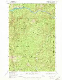
1969 Map of Thompson Point
USGS Topo · Published 1971About this map
Clearwater River North Fork terrain defines this landscape just as the local environment was undergoing a massive transformation. This survey was conducted as the region prepared for the rising waters of the Dworshak Reservoir, with blue hatching indicating areas slated for submersion once the pool reached its intended level. Two specific river access points, Butte Creek Landing and Isabella Landing, are located along the northern stretch of the water, marking the river-based economy and transportation network before the inundation. The topography reflects the intense management of the surrounding National Forest land, where river landings served as critical touchpoints for early twentieth-century timber and mountain transit.
Find a feature on this map
4 named features on this map. Tap any name to fly to it.
Don’t see what you’re looking for? This feature index may not catch every label — zoom into the map to look around manually.
Map Details
Editions of this 1969 Thompson Point Map
2 editions found
Other maps of this area

1923 · Washington Creek
USGS Topo · 1:125,000

1936 · Boehls Butte
USGS Topo · 1:48,000

1938 · Headquarters
USGS Topo · 1:48,000

1943 · Boehls Butte
USGS Topo · 1:62,500

1944 · Headquarters
USGS Topo · 1:62,500

1956 · Hamilton
USGS Topo · 1:250,000

1959 · Hamilton
USGS Topo · 1:250,000

1960 · Hamilton
USGS Topo · 1:250,000
1963 · Mallard Peak
USGS Topo · 1:24,000

1963 · Sheep Mtn
USGS Topo · 1:24,000