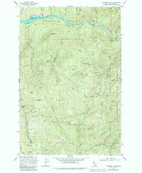
1969 Map of Thompson Point
USGS Topo · Published 1985About this map
Dworshak Reservoir dominates the northern landscape of this Idaho study, where the waters of the North Fork Clearwater River are managed within the Clearwater National Forest. The map documents a transition in the local economy and land use, showing several water-access points such as Butte Creek Landing and Isabella Landing alongside high-elevation peaks like Thompson Butte and Beaver Butte. Historically significant locations including the Old Camp Montana (Site) and Camp 14 hint at the area's logging or mining heritage. The map also records a network of primitive transportation routes, from the Salmon Ridge Trail to various unnamed jeep trails, weaving through the Sheep Mtn Range and across drainages like Lightning Creek and Harlan Creek.
Find a feature on this map
56 named features on this map. Tap any name to fly to it.
Don’t see what you’re looking for? This feature index may not catch every label — zoom into the map to look around manually.
Map Details
Editions of this 1969 Thompson Point Map
2 editions found
Other maps of this area

1923 · Washington Creek
USGS Topo · 1:125,000

1936 · Boehls Butte
USGS Topo · 1:48,000

1938 · Headquarters
USGS Topo · 1:48,000

1943 · Boehls Butte
USGS Topo · 1:62,500

1944 · Headquarters
USGS Topo · 1:62,500

1956 · Hamilton
USGS Topo · 1:250,000

1959 · Hamilton
USGS Topo · 1:250,000

1960 · Hamilton
USGS Topo · 1:250,000
1963 · Mallard Peak
USGS Topo · 1:24,000

1963 · Sheep Mtn
USGS Topo · 1:24,000