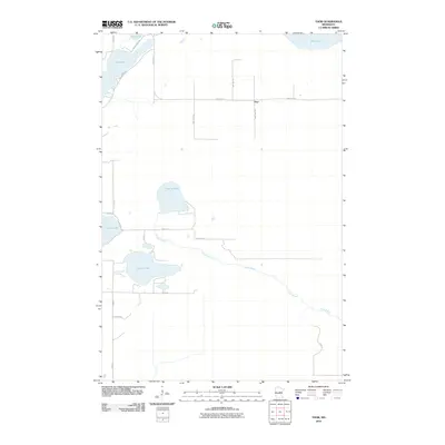
2010 Map of Thor
USGS Topo · Published 2010About this map
The small settlement of Thor serves as the focal point for this area of Aitkin County, characterized by a complex network of glacial lakes and wetlands. Water defines the local geography, with Long Lake and Lily Lake situated in the northwest, while the central landscape is shaped by the presence of Swamp Lake and the meandering path of Dam Brook. This watercourse drains toward the southeast, cutting through a grid of rural township roads and section lines.
Find a feature on this map
22 named features on this map. Tap any name to fly to it.
Don’t see what you’re looking for? This feature index may not catch every label — zoom into the map to look around manually.
Map Details
Editions of this 2010 Thor Map
This is the sole edition of this map. No revisions or reprints were ever made.
Other maps of this area

1914 · Aitkin
USGS Topo · 1:62,500

1915 · Aitkin
USGS Topo · 1:62,500

1916 · Wealthwood
USGS Topo · 1:62,500

1953 · Duluth
USGS Topo · 1:250,000

1958 · Duluth
USGS Topo · 1:250,000

1969 · Thor NE
USGS Topo · 1:24,000

1969 · Thor SE
USGS Topo · 1:24,000

1969 · Thor SW
USGS Topo · 1:24,000

1969 · Thor
USGS Topo · 1:24,000

1970 · Kimberly
USGS Topo · 1:24,000