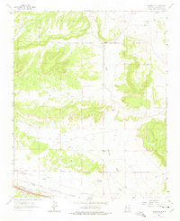
1963 Map of Thoreau
USGS Topo · Published 1975About this map
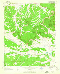
Atchison Topeka and Santa Fe railroad tracks cut across the southern plains of this McKinley County landscape, marking a vital transit corridor through the high desert. The terrain is defined by the broad path of Casamero Draw and the more restricted Mitchell Draw, which navigate the mesa-studded topography. Evidence of mid-century industrial activity is scattered across the sheet, specifically near the northern ridges where the Moe Mine and other unnamed Mines are located. These small-scale extraction points alongside a prominent Pipeline illustrate the region's 1960s economy. Local habitation is represented by the Andrews Ranch and Elkins Ranch, which appear as isolated outposts in a territory otherwise dominated by geological features like Rincon Canyon. This 1963 field-checked survey captures the area just as aerial photogrammetry was becoming the standard for documenting the American Southwest's complex drainage patterns and land-use markers.
Find a feature on this map
10 named features on this map. Tap any name to fly to it.
Don’t see what you’re looking for? This feature index may not catch every label — zoom into the map to look around manually.
Map Details
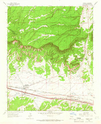
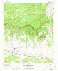
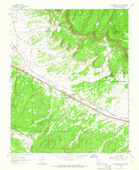
Editions of this 1963 Thoreau Map
Other maps of this area

1886 · Wingate
USGS Topo · 1:250,000

1892 · Wingate
USGS Topo · 1:250,000

1954 · Gallup
USGS Topo · 1:250,000

1958 · Gallup
USGS Topo · 1:250,000

1959 · Gallup
USGS Topo · 1:250,000

1961 · Cottonwood Canyon
USGS Topo · 1:24,000

1962 · Gallup
USGS Topo · 1:250,000
1962 · Continental Divide
USGS Topo · 1:24,000

1962 · Cottonwood Canyon
USGS Topo · 1:24,000
1963 · Hosta Butte
USGS Topo · 1:24,000