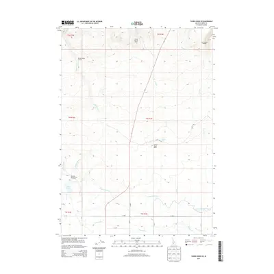
2013 Map of Thorn Creek SW
USGS Topo · Published 2013About this map
Little City of Rocks dominates the northern high ground of this Idaho landscape, where the basalt-rimmed drainages of Burnt Willow Canyon and Rattlesnake Canyon carve into the Snake River Plain transition. The southern half of the map reveals a complex irrigation infrastructure essential to the region's agricultural character. This network is anchored by the Dog Cr Reservoir, including the Dog Creek Reservoir Public Fishing Area, which feeds into the Dog Cr Drain and several critical waterways. The engineering of the high desert is evident in the paths of the N Gooding Main Canal, North Gooding Main Canal, and the Robertson Ditch, which redirect water across the arid terrain. Landforms like Turkey Head Butte and the seasonal Turkey Lake provide distinct landmarks between the rugged canyons and the man-made canals that define the valley floor.
Find a feature on this map
33 named features on this map. Tap any name to fly to it.
Don’t see what you’re looking for? This feature index may not catch every label — zoom into the map to look around manually.
Map Details
Editions of this 2013 Thorn Creek SW Map
This is the sole edition of this map. No revisions or reprints were ever made.
Other maps of this area

1949 · Gooding Butte
USGS Topo · 1:24,000

1950 · Gooding Butte
USGS Topo · 1:24,000

1955 · Twin Falls
USGS Topo · 1:250,000

1955 · Hailey
USGS Topo · 1:250,000

1957 · Thorn Creek SE
USGS Topo · 1:24,000

1957 · Thorn Creek SW
USGS Topo · 1:24,000

1957 · Thorn Creek
USGS Topo · 1:62,500

1957 · Davis Mountain
USGS Topo · 1:62,500

1958 · Twin Falls
USGS Topo · 1:250,000

1959 · Hailey
USGS Topo · 1:250,000