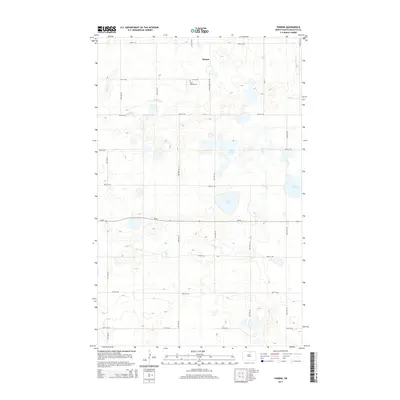
2014 Map of Thorne
USGS Topo · Published 2014About this map
Thorne sits at the northern edge of this North Dakota prairie landscape, where a grid of rural roads connects scattered homesteads and water bodies. This 2014 survey captures a quiet agricultural region defined by its hydrography, including the meandering paths of Snake Cr and Wolf Cr. For those tracing local heritage, Saint Edward Cem serves as a significant landmark along 91st St NE, while a cluster of small lakes such as Girl Lake, Twin Lake, and Little Gurr Lake dot the eastern half of the quadrangle. The map reflects a modern era of clear section lines and established state routes like ND-66, maintaining the traditional layout of Rolette County farms and open space.
Find a feature on this map
24 named features on this map. Tap any name to fly to it.
Don’t see what you’re looking for? This feature index may not catch every label — zoom into the map to look around manually.
Map Details
Editions of this 2014 Thorne Map
This is the sole edition of this map. No revisions or reprints were ever made.
Other maps of this area

1935 · Dunseith
USGS Topo · 1:48,000

1936 · Lake Upsilon
USGS Topo · 1:48,000

1939 · Dunseith
USGS Topo · 1:62,500

1942 · Lake Upsilon
USGS Topo · 1:62,500

1953 · Devils Lake
USGS Topo · 1:250,000

1954 · Overly SE
USGS Topo · 1:24,000

1954 · Minot
USGS Topo · 1:250,000

1955 · Fonda
USGS Topo · 1:24,000

1955 · Thorne
USGS Topo · 1:24,000

1955 · Rolette SW
USGS Topo · 1:24,000