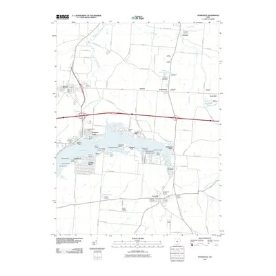
2010 Map of Thornville
USGS Topo · Published 2010About this map
Buckeye Lake and its intricate system of islands and inlets dominate this part of Licking County, showing the extensive recreational and residential developments at Fairfield Beach and Harbor Hills. To the north, the Dawes Arboretum stands as a significant managed landscape, featuring the Dawes Arboretum Pond and the Dawes Cemetery. The map documents a cluster of small settlements including Hebron, Jacksontown, and Thornville, which serve as local hubs connected by a dense grid of rural routes such as Licking Trails Rd and Cristland Hill Rd.
Find a feature on this map
101 named features on this map. Tap any name to fly to it.
Don’t see what you’re looking for? This feature index may not catch every label — zoom into the map to look around manually.
Map Details
Editions of this 2010 Thornville Map
This is the sole edition of this map. No revisions or reprints were ever made.
Other maps of this area

1907 · Thurston
USGS Topo · 1:62,500

1908 · Granville
USGS Topo · 1:62,500

1909 · Newark
USGS Topo · 1:62,500

1909 · Thornville
USGS Topo · 1:62,500

1909 · Thurston
USGS Topo · 1:62,500

1910 · Granville
USGS Topo · 1:62,500

1947 · Columbus
USGS Topo · 1:250,000

1950 · Marion
USGS Topo · 1:250,000

1961 · Columbus
USGS Topo · 1:250,000

1961 · Hanover
USGS Topo · 1:24,000