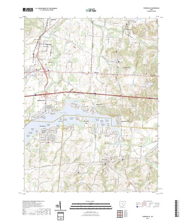
2023 Map of Thornville
USGS Topo · Published 2023About this map
Buckeye Lake dominates the central landscape of this Perry County and Licking County border region, serving as the focal point for numerous residential communities and recreation areas. Waterfront settlements such as Harbor Hills, Fairfield Beach, Thornport, and Shell Beach ring the shoreline, which is dotted with unique terrain features like Cranberry Marsh and Charleston Island. The map reveals a dense network of family history sites, including the Kemper Family Cem and the Methodist Episcopal Cem in Thornville.
Find a feature on this map
64 named features on this map. Tap any name to fly to it.
Don’t see what you’re looking for? This feature index may not catch every label — zoom into the map to look around manually.
Map Details
Editions of this 2023 Thornville Map
This is the sole edition of this map. No revisions or reprints were ever made.
Other maps of this area
1907 · Thurston
USGS Topo · 1:62,500

1908 · Granville
USGS Topo · 1:62,500

1909 · Newark
USGS Topo · 1:62,500
1909 · Thornville
USGS Topo · 1:62,500
1909 · Thurston
USGS Topo · 1:62,500

1910 · Granville
USGS Topo · 1:62,500

1947 · Columbus
USGS Topo · 1:250,000

1950 · Marion
USGS Topo · 1:250,000
1961 · Columbus
USGS Topo · 1:250,000
1961 · Hanover
USGS Topo · 1:24,000