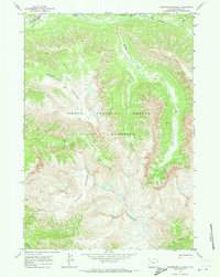
1970 Map of Thorofare Plateau
USGS Topo · Published 1973About this map
Teton National Forest encompasses this high-elevation wilderness in Wyoming, where the high terrain of the Thorofare Plateau dominates the landscape. The region is defined by its deep drainages and steep ridges, most notably the towering Thunder Mountain in the southern portion of the quadrangle. As a protected part of the Teton Wilderness, the map reveals an environment untouched by modernization, relying entirely on a network of established routes like the (Pack) Trail and various other marked Trail paths for navigation. These primitive routes follow the natural contours of the land, connecting the headwaters of major systems such as Thorofare Creek and the North Fork Yellowstone River. The map provides a detailed look at the drainage patterns of several tributaries including Hidden Creek, Elk Creek, and Battle Creek, illustrating the complex hydrology that feeds into the Yellowstone river system.
Find a feature on this map
15 named features on this map. Tap any name to fly to it.
Don’t see what you’re looking for? This feature index may not catch every label — zoom into the map to look around manually.
Map Details
Editions of this 1970 Thorofare Plateau Map
2 editions found
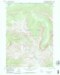
Other maps of this area

1885 · Lake
USGS Topo · 1:125,000

1893 · Ishawooa
USGS Topo · 1:125,000

1895 · Ishawooa
USGS Topo · 1:125,000

1895 · Lake
USGS Topo · 1:125,000

1896 · Lake
USGS Topo · 1:125,000

1899 · Ishawooa
USGS Topo · 1:125,000

1901 · Lake
USGS Topo · 1:125,000

1902 · Mt Leidy
USGS Topo · 1:125,000

1905 · Younts Peak
USGS Topo · 1:125,000

1906 · Lake
USGS Topo · 1:125,000