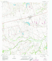
1964 Map of Thrall
USGS Topo · Published 1989About this map
The community of Thrall serves as the focal point of this Eastern Williamson County landscape, where the agricultural plains are punctuated by the industrial presence of the Thrall Oil Field, Noack Oil Field, and Beyersville Oil Field. Revised in the late 1980s, the map reveals a network of rural settlements like Noack and Beyersville connected by straight-line roads that navigate a complex system of drainage including Brushy Creek, Mustang Creek, and the curiously named Battleground Creek. Local history is anchored by Christ Ch and the adjacent Christ Ch Cem, providing a precise record for genealogists. The terrain is further defined by numerous water control structures, such as Site No 18 and Site No 4A, which manage the flow of creeks like Turkey Creek and Long Branch through the blackland prairies.
Find a feature on this map
20 named features on this map. Tap any name to fly to it.
Don’t see what you’re looking for? This feature index may not catch every label — zoom into the map to look around manually.
Map Details
Editions of this 1964 Thrall Map
2 editions found
Other maps of this area

1885 · Taylor
USGS Topo · 1:125,000

1885 · Bastrop
USGS Topo · 1:125,000

1887 · Taylor
USGS Topo · 1:125,000

1893 · Bastrop
USGS Topo · 1:125,000

1894 · Taylor
USGS Topo · 1:125,000

1904 · Bastrop
USGS Topo · 1:125,000

1948 · Elgin
USGS Topo · 1:62,500

1948 · Lexington
USGS Topo · 1:62,500

1950 · Lexington
USGS Topo · 1:62,500

1950 · Elgin
USGS Topo · 1:62,500