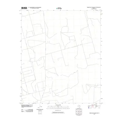
2010 Map of Three Bluff Draw NW
USGS Topo · Published 2010About this map
The West Texas landscape of Glasscock County is defined here by a geometric network of ranch and farm roads, reflecting the region's enduring agricultural and ranching layout in the early 21st century. Ranch Rd 33 and Fm 33 N serve as the primary north-south corridors through this expanse, intersected by several county routes such as Co Rd 170 and Co Rd 11. The presence of Farm Rd 2401 highlights the area's transition between managed farmland and open ranch land. Unlike more densely populated regions, this area is characterized by large land tracts accessible via long, straight thoroughfares like Hirt Rd and the appropriately named Angle Rd. This survey captures the specific road infrastructure that supports the remote homesteads and energy interests of the Three Bluff Draw vicinity.
Find a feature on this map
9 named features on this map. Tap any name to fly to it.
Don’t see what you’re looking for? This feature index may not catch every label — zoom into the map to look around manually.
Map Details
Editions of this 2010 Three Bluff Draw NW Map
This is the sole edition of this map. No revisions or reprints were ever made.
Other maps of this area

1954 · San Angelo
USGS Topo · 1:250,000

1958 · San Angelo
USGS Topo · 1:250,000

1963 · Currie Reservoir
USGS Topo · 1:24,000

1963 · Garden City
USGS Topo · 1:24,000

1965 · San Angelo
USGS Topo · 1:250,000

1965 · Dewey Lake SE
USGS Topo · 1:24,000

1973 · Three Bluff Draw
USGS Topo · 1:24,000

1973 · Three Bluff Draw NE
USGS Topo · 1:24,000

1973 · Saint Lawrence SE
USGS Topo · 1:24,000
1973 · Three Bluff Draw NW
USGS Topo · 1:24,000