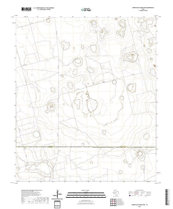
2022 Map of Three Bluff Draw NW
USGS Topo · Published 2022About this map
The high plains of West Texas are defined here by the meeting of Glasscock Co and Reagan Co, a landscape marked by its utility and isolation. This area is crisscrossed by a network of ranching and farm roads, most notably Ranch Rd 33 and Farm Rd 2401, which facilitate the region's agricultural and industrial life. The terrain is relatively flat, dotted with numerous intermittent depressions or wetlands that characterize the drainage patterns of the Llano Estacado. Small, localized features such as Radio Tower Rd and Angle Rd suggest a modern infrastructure supporting telecommunications and local access between expansive properties. The arrangement of these thoroughfares, including Co Rd 280 and Co Rd 105, illustrates the systematic division of land typical of this semi-arid plateau.
Find a feature on this map
9 named features on this map. Tap any name to fly to it.
Don’t see what you’re looking for? This feature index may not catch every label — zoom into the map to look around manually.
Map Details
Editions of this 2022 Three Bluff Draw NW Map
This is the sole edition of this map. No revisions or reprints were ever made.
Other maps of this area

1954 · San Angelo
USGS Topo · 1:250,000

1958 · San Angelo
USGS Topo · 1:250,000

1963 · Currie Reservoir
USGS Topo · 1:24,000

1963 · Garden City
USGS Topo · 1:24,000

1965 · San Angelo
USGS Topo · 1:250,000

1965 · Dewey Lake SE
USGS Topo · 1:24,000

1973 · Three Bluff Draw
USGS Topo · 1:24,000

1973 · Three Bluff Draw NE
USGS Topo · 1:24,000

1973 · Saint Lawrence SE
USGS Topo · 1:24,000
1973 · Three Bluff Draw NW
USGS Topo · 1:24,000