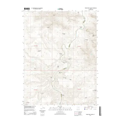
2014 Map of Three Fords Canyon
USGS Topo · Published 2014About this map
The Green River carves a deep, winding path through this desert corridor on the boundary of Emery and Grand Counties. The landscape is defined by the river’s descent through a series of named hazards, including Three Fords Rapids, Last Chance Rapids, and Range Creek Rapids. These water features dictated the movement of early travelers and river runners through a terrain marked by formidable vertical relief, from the low-lying Beaver Slide Bottom to the heights of Pinnacle Mesa and Boulder Mesa.
Find a feature on this map
34 named features on this map. Tap any name to fly to it.
Don’t see what you’re looking for? This feature index may not catch every label — zoom into the map to look around manually.
Map Details
Editions of this 2014 Three Fords Canyon Map
This is the sole edition of this map. No revisions or reprints were ever made.
Other maps of this area

1885 · East Tavaputs
USGS Topo · 1:250,000

1886 · Price River
USGS Topo · 1:250,000

1896 · Price River
USGS Topo · 1:250,000

1954 · Range Creek
USGS Topo · 1:62,500

1956 · Price
USGS Topo · 1:250,000

1956 · Grand Junction
USGS Topo · 1:250,000

1959 · Grand Junction
USGS Topo · 1:250,000

1960 · Price
USGS Topo · 1:250,000

1960 · Grand Junction
USGS Topo · 1:250,000

1962 · Grand Junction
USGS Topo · 1:250,000