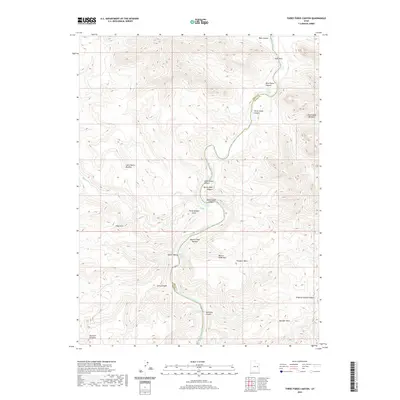
2020 Map of Three Fords Canyon
USGS Topo · Published 2020About this map
The Green River carves a winding path through this corner of Grand and Emery counties, defining a landscape of severe vertical relief and high desert plateaus. The river's course is punctuated by several significant white-water features, including Three Fords Rapids, Range Creek Rapids, and Saleratus Rapids, which historically presented major navigational hurdles for early canyon explorers and surveyors. Along the banks, distinct topographic features such as Beaver Slide Bottom and Rabbit Valley indicate the few areas where the canyon walls recede enough to provide level ground near the water.
Find a feature on this map
31 named features on this map. Tap any name to fly to it.
Don’t see what you’re looking for? This feature index may not catch every label — zoom into the map to look around manually.
Map Details
Editions of this 2020 Three Fords Canyon Map
This is the sole edition of this map. No revisions or reprints were ever made.
Other maps of this area

1885 · East Tavaputs
USGS Topo · 1:250,000

1886 · Price River
USGS Topo · 1:250,000

1896 · Price River
USGS Topo · 1:250,000

1954 · Range Creek
USGS Topo · 1:62,500

1956 · Price
USGS Topo · 1:250,000

1956 · Grand Junction
USGS Topo · 1:250,000

1959 · Grand Junction
USGS Topo · 1:250,000

1960 · Price
USGS Topo · 1:250,000

1960 · Grand Junction
USGS Topo · 1:250,000

1962 · Grand Junction
USGS Topo · 1:250,000