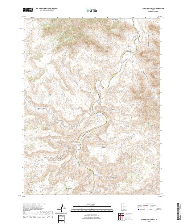
2023 Map of Three Fords Canyon
USGS Topo · Published 2023About this map
The Green Wild and Scenic River carves a deep path through the borderlands of Emery and Grand Counties, defining a landscape dominated by dramatic vertical shifts and narrow canyons. This segment of Desolation Canyon is characterized by a series of significant river features, including Three Fords Rapids and Last Chance Rapids, which reflect the powerful hydraulic forces at work in this arid region. The eastern portion is anchored by the high elevations of the McPherson Range and Jacks Rock, while the western side features prominent plateau formations such as Last Chance Benches and Big Horn Benches. Topographic landmarks like the Three Golden Stairs and the Beaver Slide Rim provide a glimpse into the naming conventions used by those who navigated and surveyed this canyon system, while broad overlooks like Pinnacle Mesa and Boulder Mesa stand high above the canyon floor.
Find a feature on this map
35 named features on this map. Tap any name to fly to it.
Don’t see what you’re looking for? This feature index may not catch every label — zoom into the map to look around manually.
Map Details
Editions of this 2023 Three Fords Canyon Map
This is the sole edition of this map. No revisions or reprints were ever made.
Other maps of this area

1885 · East Tavaputs
USGS Topo · 1:250,000

1886 · Price River
USGS Topo · 1:250,000

1896 · Price River
USGS Topo · 1:250,000

1954 · Range Creek
USGS Topo · 1:62,500

1956 · Price
USGS Topo · 1:250,000

1956 · Grand Junction
USGS Topo · 1:250,000

1959 · Grand Junction
USGS Topo · 1:250,000

1960 · Price
USGS Topo · 1:250,000

1960 · Grand Junction
USGS Topo · 1:250,000

1962 · Grand Junction
USGS Topo · 1:250,000