
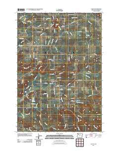
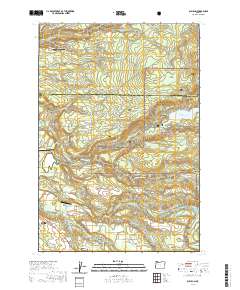
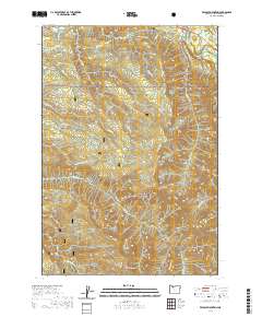
1985 Map of Three Lynx
USGS Topo · Published 1986About this map
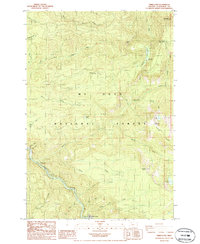
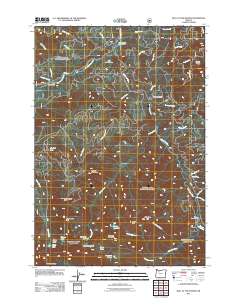
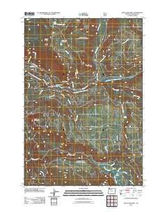
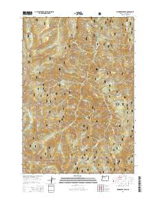
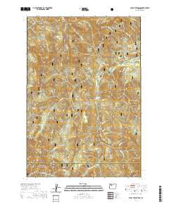
Three Lynx stands as the primary human outpost along the steep canyon walls of the Clackamas River in this mid-1980s provisional survey. The landscape is dominated by the dense drainage networks of the Mt Hood National Forest, where the Roaring River and South Fork Eagle Creek carve through the timberlands. This map reveals a specialized recreation and resource-extraction economy, evidenced by several remote campsites like Sunstrip Campground and Lookout Springs Campground interspersed with active Quarry and Gravel Pit sites. High-altitude features such as Squaw Mtn and Sheepshead Rock overlook a series of alpine waters, including Squaw Lakes and Shining Lake WL 3893T. For the local historian, the map details the precise alignment of the Indian Ridge Tr and the confluence of several family-named tributaries like Murphy Creek and Morse Creek, which illustrate the complex topography of the Oregon Cascades during this era.
Find a feature on this map
40 named features on this map. Tap any name to fly to it.
Don’t see what you’re looking for? This feature index may not catch every label — zoom into the map to look around manually.
Map Details
Editions of this 1985 Three Lynx Map
2 editions found
Historical Maps of Three Lynx Through Time
190 maps found

1954 Redland
Clackamas County, OR

1955 Cherryville
Clackamas County, OR

1955 Colton
Clackamas County, OR

1955 Colton
Clackamas County, OR

1955 Wilhoit
Clackamas County, OR

1955 Yoder
Clackamas County, OR

1956 Fish Creek Mtn
Clackamas County, OR

1956 High Rock
Clackamas County, OR

1961 Redland
Clackamas County, OR

1962 Bull Run Lake
Clackamas County, OR

1962 Hickman Butte
Clackamas County, OR

1985 Bagby Hot Springs
Clackamas County, OR

1985 Bull of The Woods
Clackamas County, OR

1985 Bull Run
Clackamas County, OR

1985 Cherryville
Clackamas County, OR

1985 Fish Creek Mountain
Clackamas County, OR

1985 High Rock
Clackamas County, OR

1985 Mt. Mitchell
Clackamas County, OR

1985 Rooster Rock
Clackamas County, OR
1985 Three Lynx
Clackamas County, OR

1985 Timothy Lake
Clackamas County, OR

1985 Wanderers Peak
Clackamas County, OR

1985 Wildcat Mountain
Clackamas County, OR

1985 Wolf Peak
Clackamas County, OR

1986 Bedford Point
Clackamas County, OR

1986 Brightwood
Clackamas County, OR

1986 Elwood
Clackamas County, OR

1986 Fernwood
Clackamas County, OR

1986 Gawley Creek
Clackamas County, OR

1986 Mt. Lowe
Clackamas County, OR

1986 Pinhead Buttes
Clackamas County, OR

1986 Soosap Peak
Clackamas County, OR

1997 Bagby Hot Springs
Clackamas County, OR

1997 Bedford Point
Clackamas County, OR

1997 Brightwood
Clackamas County, OR

1997 Bull of the Woods
Clackamas County, OR

1997 Bull Run
Clackamas County, OR

1997 Bull Run Lake
Clackamas County, OR

1997 Cherryville
Clackamas County, OR

1997 Elwood
Clackamas County, OR

1997 Fish Creek Mountain
Clackamas County, OR

1997 Hickman Butte
Clackamas County, OR

1997 High Rock
Clackamas County, OR

1997 Mount Lowe
Clackamas County, OR

1997 Mount Mitchell
Clackamas County, OR

1997 Pinhead Buttes
Clackamas County, OR

1997 Rooster Rock
Clackamas County, OR

1997 Soosap Peak
Clackamas County, OR

1997 Three Lynx
Clackamas County, OR

1997 Timothy Lake
Clackamas County, OR

1997 Wanderers Peak
Clackamas County, OR

1997 Wildcat Mountain
Clackamas County, OR

1997 Wolf Peak
Clackamas County, OR
2011 Bagby Hot Springs
Clackamas County, OR
2011 Bedford Point
Clackamas County, OR
2011 Brightwood
Clackamas County, OR
2011 Bull of the Woods
Clackamas County, OR
2011 Bull Run
Clackamas County, OR
2011 Bull Run Lake
Clackamas County, OR
2011 Cherryville
Clackamas County, OR
2011 Colton
Clackamas County, OR
2011 Elwood
Clackamas County, OR
2011 Fernwood
Clackamas County, OR
2011 Fish Creek Mountain
Clackamas County, OR
2011 Gawley Creek
Clackamas County, OR
2011 Hickman Butte
Clackamas County, OR
2011 High Rock
Clackamas County, OR
2011 Mount Lowe
Clackamas County, OR
2011 Mount Mitchell
Clackamas County, OR
2011 Pinhead Buttes
Clackamas County, OR

2011 Redland
Clackamas County, OR
2011 Rooster Rock
Clackamas County, OR
2011 Soosap Peak
Clackamas County, OR
2011 Three Lynx
Clackamas County, OR
2011 Timothy Lake
Clackamas County, OR
2011 Wanderers Peak
Clackamas County, OR
2011 Wildcat Mountain
Clackamas County, OR
2011 Wilhoit
Clackamas County, OR
2011 Wolf Peak
Clackamas County, OR
2011 Yoder
Clackamas County, OR
2014 Bagby Hot Springs
Clackamas County, OR
2014 Bedford Point
Clackamas County, OR
2014 Brightwood
Clackamas County, OR
2014 Bull of the Woods
Clackamas County, OR
2014 Bull Run
Clackamas County, OR
2014 Bull Run Lake
Clackamas County, OR
2014 Cherryville
Clackamas County, OR
2014 Colton
Clackamas County, OR
2014 Elwood
Clackamas County, OR
2014 Fernwood
Clackamas County, OR
2014 Fish Creek Mountain
Clackamas County, OR
2014 Gawley Creek
Clackamas County, OR
2014 Hickman Butte
Clackamas County, OR
2014 High Rock
Clackamas County, OR
2014 Mount Lowe
Clackamas County, OR
2014 Mount Mitchell
Clackamas County, OR
2014 Pinhead Buttes
Clackamas County, OR

2014 Redland
Clackamas County, OR
2014 Rooster Rock
Clackamas County, OR
2014 Soosap Peak
Clackamas County, OR
2014 Three Lynx
Clackamas County, OR
2014 Timothy Lake
Clackamas County, OR
2014 Wanderers Peak
Clackamas County, OR
2014 Wildcat Mountain
Clackamas County, OR
2014 Wilhoit
Clackamas County, OR

2014 Wolf Peak
Clackamas County, OR
2014 Yoder
Clackamas County, OR
2017 Bagby Hot Springs
Clackamas County, OR
2017 Bedford Point
Clackamas County, OR
2017 Brightwood
Clackamas County, OR
2017 Bull of the Woods
Clackamas County, OR
2017 Bull Run
Clackamas County, OR
2017 Bull Run Lake
Clackamas County, OR
2017 Cherryville
Clackamas County, OR
2017 Colton
Clackamas County, OR

2017 Elwood
Clackamas County, OR
2017 Fernwood
Clackamas County, OR
2017 Fish Creek Mountain
Clackamas County, OR
2017 Gawley Creek
Clackamas County, OR

2017 Hickman Butte
Clackamas County, OR
2017 High Rock
Clackamas County, OR
2017 Mount Lowe
Clackamas County, OR
2017 Mount Mitchell
Clackamas County, OR
2017 Pinhead Buttes
Clackamas County, OR
2017 Redland
Clackamas County, OR
2017 Rooster Rock
Clackamas County, OR
2017 Soosap Peak
Clackamas County, OR
2017 Three Lynx
Clackamas County, OR
2017 Timothy Lake
Clackamas County, OR
2017 Wanderers Peak
Clackamas County, OR
2017 Wildcat Mountain
Clackamas County, OR
2017 Wilhoit
Clackamas County, OR
2017 Wolf Peak
Clackamas County, OR

2017 Yoder
Clackamas County, OR
2020 Bagby Hot Springs
Clackamas County, OR
2020 Bedford Point
Clackamas County, OR
2020 Brightwood
Clackamas County, OR
2020 Bull of the Woods
Clackamas County, OR
2020 Bull Run
Clackamas County, OR
2020 Bull Run Lake
Clackamas County, OR
2020 Cherryville
Clackamas County, OR
2020 Colton
Clackamas County, OR
2020 Elwood
Clackamas County, OR
2020 Fernwood
Clackamas County, OR
2020 Fish Creek Mountain
Clackamas County, OR

2020 Gawley Creek
Clackamas County, OR
2020 Hickman Butte
Clackamas County, OR
2020 High Rock
Clackamas County, OR
2020 Mount Lowe
Clackamas County, OR
2020 Mount Mitchell
Clackamas County, OR

2020 Pinhead Buttes
Clackamas County, OR
2020 Redland
Clackamas County, OR
2020 Rooster Rock
Clackamas County, OR
2020 Soosap Peak
Clackamas County, OR
2020 Three Lynx
Clackamas County, OR
2020 Timothy Lake
Clackamas County, OR

2020 Wanderers Peak
Clackamas County, OR
2020 Wildcat Mountain
Clackamas County, OR
2020 Wilhoit
Clackamas County, OR
2020 Wolf Peak
Clackamas County, OR
2020 Yoder
Clackamas County, OR

2023 Bagby Hot Springs
Clackamas County, OR
2023 Bedford Point
Clackamas County, OR

2023 Bull of the Woods
Clackamas County, OR

2023 Bull Run
Clackamas County, OR
2023 Cherryville
Clackamas County, OR

2023 Colton
Clackamas County, OR

2023 Fernwood
Clackamas County, OR

2023 Gawley Creek
Clackamas County, OR

2023 Mount Mitchell
Clackamas County, OR

2023 Redland
Clackamas County, OR

2023 Soosap Peak
Clackamas County, OR

2023 Three Lynx
Clackamas County, OR

2023 Timothy Lake
Clackamas County, OR

2023 Wanderers Peak
Clackamas County, OR

2023 Wildcat Mountain
Clackamas County, OR

2023 Wilhoit
Clackamas County, OR

2023 Yoder
Clackamas County, OR

2024 Bedford Point
Clackamas County, OR

2024 Brightwood
Clackamas County, OR

2024 Bull Run Lake
Clackamas County, OR

2024 Cherryville
Clackamas County, OR

2024 Elwood
Clackamas County, OR

2024 Fish Creek Mountain
Clackamas County, OR

2024 Hickman Butte
Clackamas County, OR

2024 High Rock
Clackamas County, OR

2024 Mount Lowe
Clackamas County, OR

2024 Pinhead Buttes
Clackamas County, OR

2024 Rooster Rock
Clackamas County, OR

2024 Wolf Peak
Clackamas County, OR