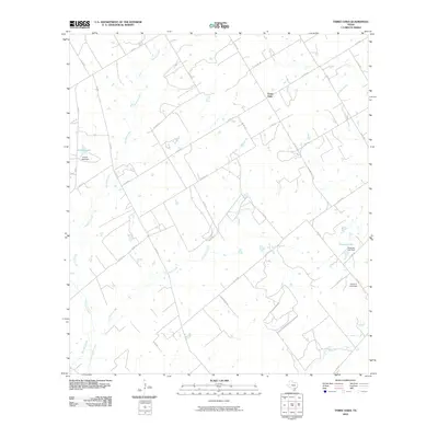
2010 Map of Three Oaks
USGS Topo · Published 2010About this map
Three Oaks sits at the center of a landscape defined by an extensive network of drainage creeks and managed water resources in Wilson County. The terrain is notably etched by the winding paths of Sulphur Creek, Cat Creek, and Los Cortes Creek, which dominate the local hydrology. The presence of engineered structures like Grimes Lake Dam, Tessman Lake Dam, and the evocatively named Uranium Lake Dam suggests a history of localized water management for agricultural or industrial use. The map reveals a highly structured rural grid of farm-to-market roads and county routes, including F.M. 541 and F.M. 2505, which connect isolated farmsteads and agricultural plots. This road network, following the natural contours of the creek beds and low-lying areas, illustrates the transition of traditional ranching and farming lands into the early 21st century.
Find a feature on this map
35 named features on this map. Tap any name to fly to it.
Don’t see what you’re looking for? This feature index may not catch every label — zoom into the map to look around manually.
Map Details
Editions of this 2010 Three Oaks Map
This is the sole edition of this map. No revisions or reprints were ever made.
Other maps of this area

1925 · Tordia No. 1
USGS Topo · 1:48,000

1931 · Falls City
USGS Topo · 1:62,500

1936 · Floresville
USGS Topo · 1:62,500

1953 · Crystal City
USGS Topo · 1:250,000

1954 · San Antonio
USGS Topo · 1:250,000

1955 · Crystal City
USGS Topo · 1:250,000

1956 · Pleasanton
USGS Topo · 1:62,500

1957 · San Antonio
USGS Topo · 1:250,000

1961 · Crystal City
USGS Topo · 1:250,000
1961 · Falls City
USGS Topo · 1:24,000