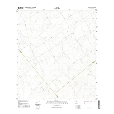
2016 Map of Three Oaks
USGS Topo · Published 2016About this map
Three Oaks sits at the northern edge of a rural landscape defined by the convergence of three Texas counties: Wilson, Atascosa, and Karnes. This 2016 survey illustrates a terrain primarily organized around agricultural ranching and water management, where numerous small creeks like Sulphur Cr and Los Cortes Cr drain into local basins. The topography is dotted with specific named water bodies such as Grimes Lake, Tessman Lake, and the distinctly named Uranium Lake in the southeast corner. A dense network of farm-to-market roads and county routes, including FM 541 and FM 1344, provides the framework for the area's modern land divisions and property access, reflecting the region's enduring cattle and farming heritage near the South Texas Plains.
Find a feature on this map
41 named features on this map. Tap any name to fly to it.
Don’t see what you’re looking for? This feature index may not catch every label — zoom into the map to look around manually.
Map Details
Editions of this 2016 Three Oaks Map
This is the sole edition of this map. No revisions or reprints were ever made.
Other maps of this area

1925 · Tordia No. 1
USGS Topo · 1:48,000

1931 · Falls City
USGS Topo · 1:62,500

1936 · Floresville
USGS Topo · 1:62,500

1953 · Crystal City
USGS Topo · 1:250,000

1954 · San Antonio
USGS Topo · 1:250,000

1955 · Crystal City
USGS Topo · 1:250,000

1956 · Pleasanton
USGS Topo · 1:62,500

1957 · San Antonio
USGS Topo · 1:250,000

1961 · Crystal City
USGS Topo · 1:250,000
1961 · Falls City
USGS Topo · 1:24,000