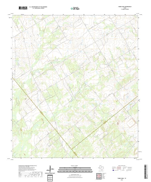
2022 Map of Three Oaks
USGS Topo · Published 2022About this map
The tri-county junction of Wilson, Karnes, and Atascosa counties creates a unique convergence of administrative boundaries across this South Texas landscape. This rural terrain is characterized by a network of seasonal watercourses, including the winding Los Cortes Cr and Sulphur Cr, which drain into localized basins like Grimes Lake. The road network is primarily composed of ranch-to-market routes such as FM 541 and FM 1344, alongside numerous county roads like Co RD 207 and Co RD 214 that follow the property lines of large agricultural tracts. The presence of Tessman Lake and Tordillo Cr in the eastern and southern reaches highlights the subtle variations in the drainage patterns of this brush-country environment, where water remains the primary driver of both historical land use and modern infrastructure.
Find a feature on this map
39 named features on this map. Tap any name to fly to it.
Don’t see what you’re looking for? This feature index may not catch every label — zoom into the map to look around manually.
Map Details
Editions of this 2022 Three Oaks Map
This is the sole edition of this map. No revisions or reprints were ever made.
Other maps of this area

1925 · Tordia No. 1
USGS Topo · 1:48,000

1931 · Falls City
USGS Topo · 1:62,500

1936 · Floresville
USGS Topo · 1:62,500

1953 · Crystal City
USGS Topo · 1:250,000

1954 · San Antonio
USGS Topo · 1:250,000

1955 · Crystal City
USGS Topo · 1:250,000

1956 · Pleasanton
USGS Topo · 1:62,500

1957 · San Antonio
USGS Topo · 1:250,000

1961 · Crystal City
USGS Topo · 1:250,000
1961 · Falls City
USGS Topo · 1:24,000